I have tried a couple of methodologies using a point cloud (LAS) to generate a TIN however the quality of the TIN is not good when it comes to trees and the TIN gives steep surfaces below the tree canopy (because the underneath of the tree is not observable). Altering the tolerance can flatten out other trees too much where there is an ability to view through to the canopy floor. It would be more ideal to use already generated meshes and be able to apply the raster image from the geotiff over (Drape) the mesh file. Draping is more realistic and preferable to the textured mesh that comes with the product produced by these programs.
Mesh files are .PLY, .FBX, .DXF, .OBJ, or 3D .PDF
I've looked at
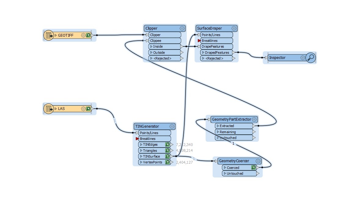
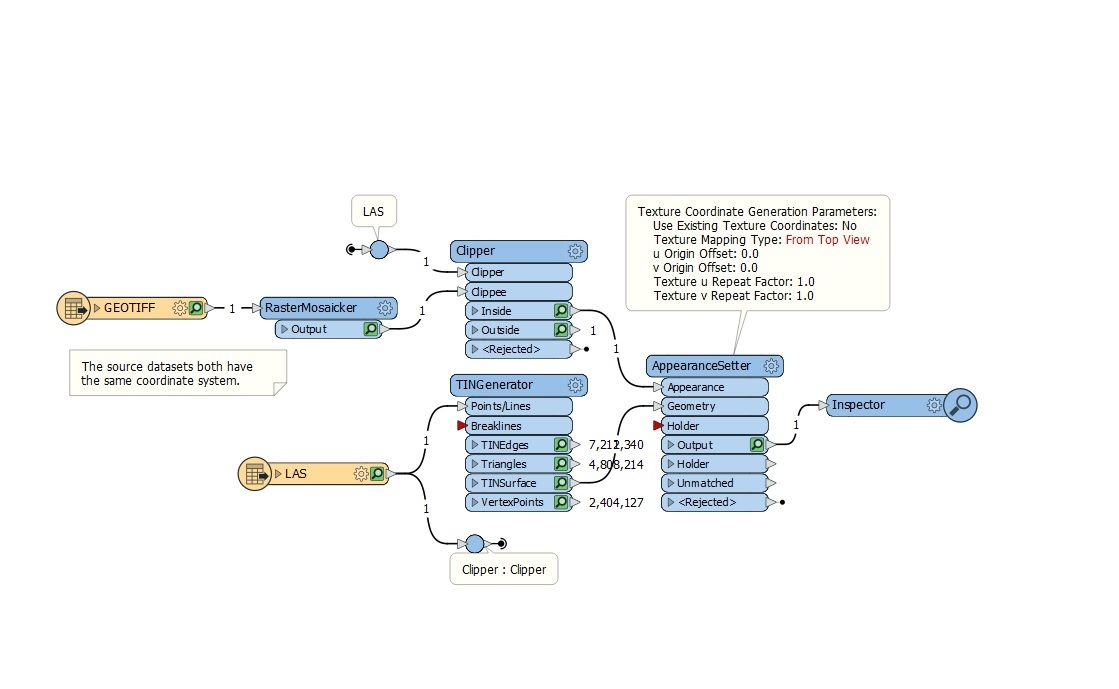
Draping polygonal features on a TIN?But had problems getting the right parameter into the GeometryPartExtractor.
This was a Geometry XQuery : Geometry IFME polygon.
and
Draping imagery textures on terrain surfacesand the texture mapping demo
Any advice to improve the TIN or utilise the existing mesh products instead would be appreciated.
@takashi