Hello, I want to convert 2D pipeline(shapefile or Esri File Geodatabase) to 3D pipleline to put it into cesium,Do you have any idea?Thanks


 +22
+22
- Contributor
- 1961 replies
-
29 October 2019

What sort of information do you have in regards to the elevation of the pipelines?
What sort of information do you have in regards to the elevation of the pipelines?
I have 3 fields to store the pipelines's elevation
+22
- Contributor
- 1961 replies
-
30 October 2019
I have 3 fields to store the pipelines's elevation
I meant, is each pipeline a constant z, or do you have a z value for each vertex, or do you have certain z values, and the others need to be interpolated.
If any of the that, is it an absolute elevation or a height (depth) relative to the ground surface?
Is this information stored in an attribute on the feature or is coming from an ancillary dataset?
Thanks for your replying,my pipe data has two feature layers(table),a point layer and a polyline layer.Each pipeline has only two vertexes and the vertext's information is in the point layer(x,y,elevation.etc.),the line has no elevation information just some name,length,projectname property etc.my pipe has no Z value but if needed,i can have the Z value. The elevation in the point layer has 3 types,include absolute elevation and the relative.
+22
- Contributor
- 1961 replies
-
31 October 2019
You can use a spatialRelator to transfer the elevation attributes from the points to the polylines.
Then use a 3DInterpolator on the polylines, setting the Starting and Ending Elevation to the attributes transferred from the points.

Userlevel 4
 +26
+26
- Safer
- 2401 replies
-
31 October 2019

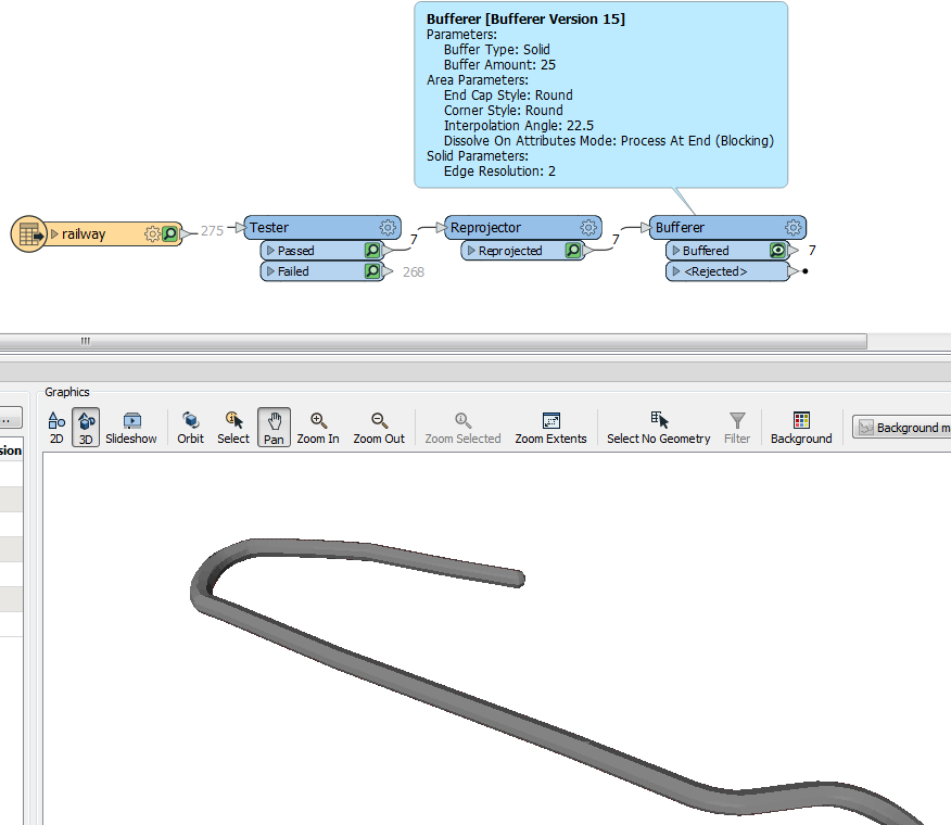
If you want your pipelines to be solid (i.e. not just zero-width lines but actually matching the diameter of the pipeline) then you can use the Bufferer transformer.
Set the buffer type to solid and enter the pipe radius.
Here's an example of a subway line buffered to 25 metres:


Userlevel 3
 +18
+18
- Enthusiast
- 97 replies
-
31 October 2019

I think, if i understand your question well, there was this similar question last week with several approaches to solve this issue
https://knowledge.safe.com/questions/101146/help-2d-lines-to-3d-using-some-known-3d-points.html
Reply
Enter your E-mail address. We'll send you an e-mail with instructions to reset your password.